Map data © OpenStreetMap contributors.
What you're looking at
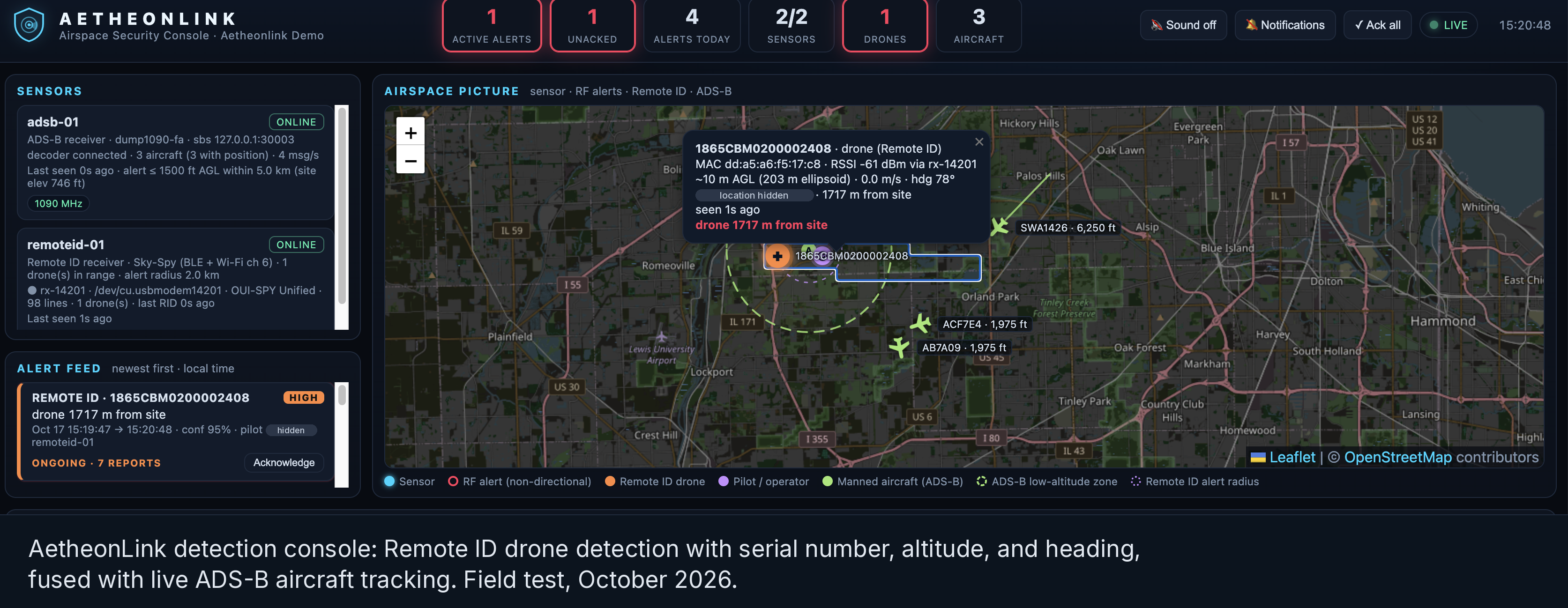
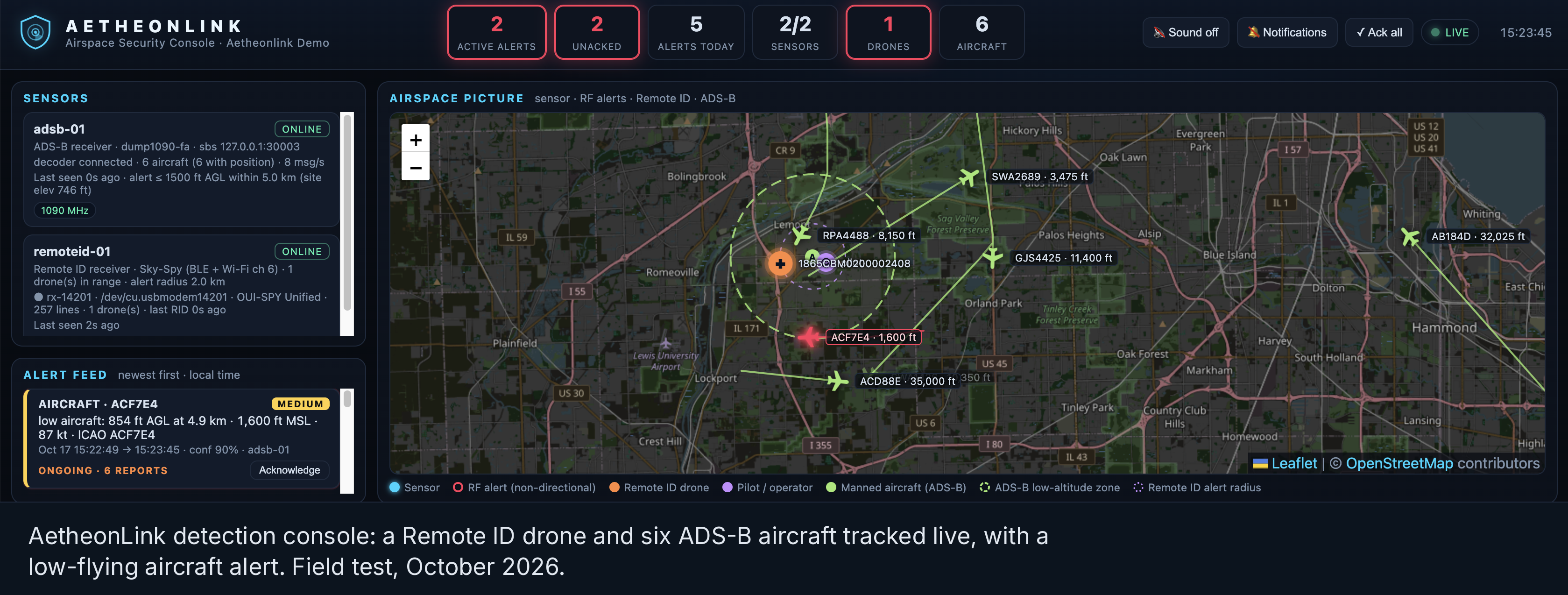
Two commercial passive sensors — a Remote ID receiver and an ADS-B receiver — feeding one fused airspace picture. A drone is detected and identified (serial, position, altitude, heading, and the operator location it broadcasts under FAA Remote ID); crewed aircraft are tracked alongside it; anything flying low inside the site radius raises an automatic alert. Everything on one map, built on an open, vendor-neutral pipeline — the same architecture that scales to a protected facility.
What Aetheonlink delivers
Drone detection at critical sites
Detect, track, and identify small drones surveilling hangars, launch areas, and ground stations — passively, inside the lawful detect-and-alert lane.
GPS & RF interference monitoring
Detect GPS jamming, spoofing, and unusual RF activity around the site — interference seen and attributed, not just felt.
Vendor-neutral design & integration
Pick the right detection mix for the site, cut false alarms, and feed clean alerts into TAK and your existing security operations.
Detect and alert only. No jamming. Nothing classified. Recorded field test, October 2026 — test data captured over public airspace; no client sites depicted.